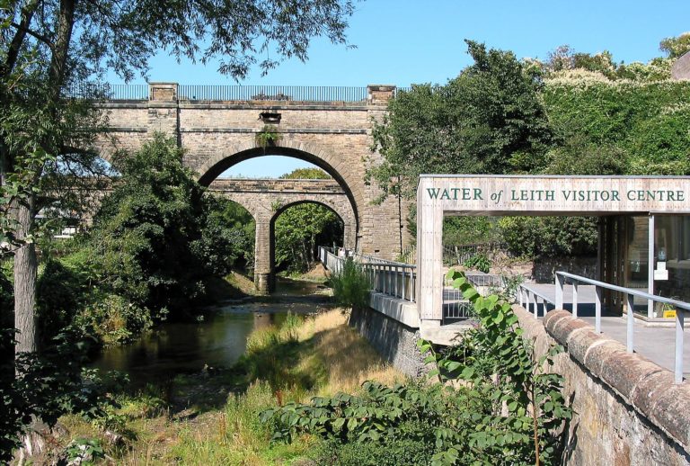

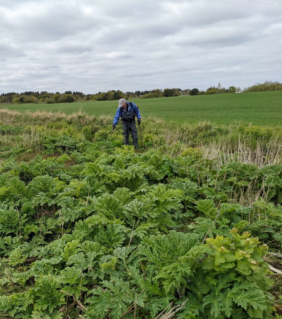
We have just completed the third year of treating Giant Hogweed on the whole length of the Water of Leith. The most upstream plant is in Currie, so this works requires the management of 10 miles of river. Every plant that is treated is mapped on a GPS so that at the end of the season we can look more closely at the data and work out what impact we are having and whether our management of this plant is working
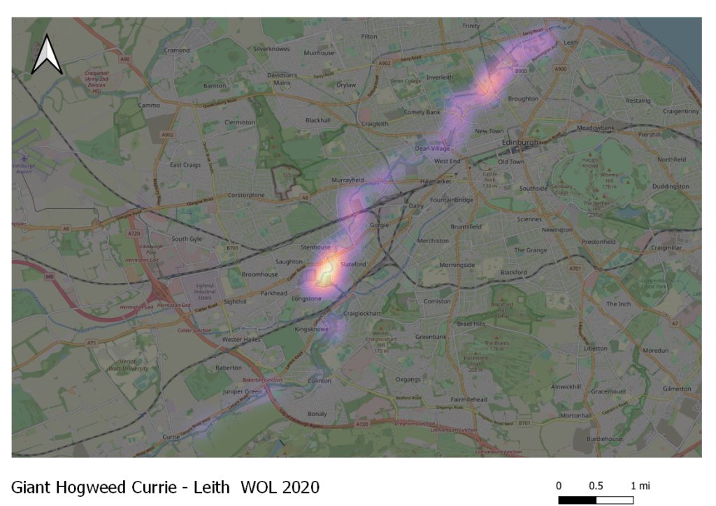
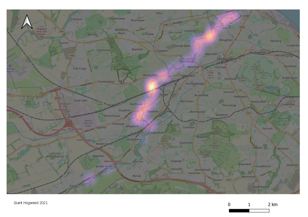
Heat maps are a visual representation of the plant data, which show the density of plants on the whole river in 2020, 2021, 2022. The area of the map which looks white hot are where there are the highest number of plants compared to the distribution of plants along the whole length of the river. When looking at the data in this way it is possible to see potential seed sources on the river
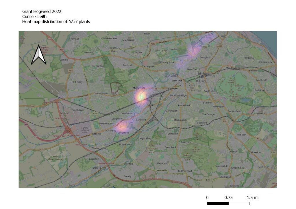
In 2020 the white hot area of the map revealed that the Murrayburn was inundated with Giant Hogweed and was not managed so these seeds were spreading into the WOL from Longstone. This is why since 2021 the WOLCT has been managing plants on the Murrayburn with Forth Rivers Trust and various land owners. We are already seeing the impact of this as in 2021, 2022 the densest area for Giant Hogweed is now Murrayfield. In 2022 we recorded 5757 plants on 10 miles of river.
There are now only 111 plants between Currie and Longstone (4 miles of river) which indicates the success of the Trusts previous management. This is represented by the fading colour on the heat map in 2020, 2021 until in 2022 there is no longer showing up as 98 % of all Giant Hogweed plants can be found between Longstone and Leith (6 miles of river). We are feeling very encouraged by the results of the heat map as you can see the hotspot for Giant Hogweed moving further and further downstream, which means that there is less river that can be re seeded by Giant Hogweed plants in the future. Next year we need to take a closer look at Murrayfield and workout why this area is a hotspot. Could it be that due to the two stage flood defense channel, the river deposits seeds as it widens in flood situations. Or could it be that there is another seed source yet to be discovered – perhaps from the railway or tramline ?
Although we would not say that this battle is over, the results show that we are certainly moving in the right direction !